The Turf column in the May edition of GCM magazine addressed steps a superintendent can take to begin using drones on the golf course. Researchers at the University of Arkansas — Wendell Hutchens, Ph.D., and doctoral horticulture student Daniel
O’Brien, both with the university’s Agricultural Experiment Station — shared their top tips on how to get started.
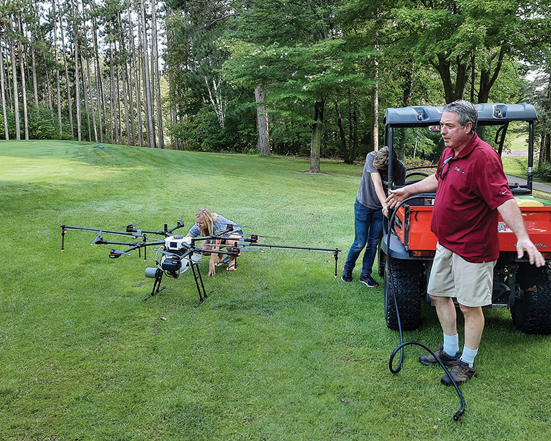
The researchers have also looked at how labor costs can be reduced by using drones.
Superintendents may question how any labor savings would be offset by new labor costs associated with time spent operating the drones with someone on their own staff or hiring an operator to fly the drones.
“Balancing potential labor savings versus costs is obviously going to be different for each course and has to be evaluated on an individual basis,” O’Brien says.
“However, generally speaking, drone usage in conjunction with other technologies (such as GPS sprayers) can be substantial, especially when the drone is used to an optimal level,” Hutchens says. “The labor and financial savings from
using a drone or other remote sensing tools far outweighs the additional labor it would take to learn to use one.”
“It comes back to the idea of drones as scouting tools and addressing the question of where labor is needed out on the course,” O’Brien says. “Essentially, it becomes a matter of comparing what drones offer to current methods of
scouting and course assessments.”
O’Brien gave an example from their own research program.
“Our traditional methods for photographing research plots can be very time-consuming and only give us a subsample of the total area — less than 10%,” he says. “With drones, now we’re capturing 100% of every plot in a fraction
of the time. Translating that to the golf course, the question for superintendents is, ‘How much of your course are you able to put your eyes on each day, and what if you could increase that by 10 times?’ It all ties back to identifying
where issues are happening. Being able to direct available resources to the places where they’re needed most has major implications for savings on labor as well as materials.”
O’Brien made an analogy between flying a drone and spraying pesticides.
“It is a specialized job that requires a license, which requires some training, and ultimately, it’s beneficial to have a designated crew member specializing in that role,” he says. “It doesn’t mean that other crew members
can’t perform the operation (under supervision), but the nature of the job lends itself to specialization and does not require that every member of the crew be able to do it.”
Balancing costs with benefits boils down to two questions, O’Brien says. First, when it comes to the crew member flying the drone, what would they be doing if they were not flying a drone? Second, for all the other crew members (not flying the drone),
did the information provided by the drone flight make them more efficient or productive in their jobs?
“Tradeoffs between using drones in-house versus contracting the work out go back to defining why you want to fly,” O’Brien says. “Here it’s helpful to view the overall operation as a two-part process: 1) flying — everything
that happens up in the air with image/data acquisition, and 2) everything that happens after the flight — turning drone images into actionable information.”
If the goal is to create technical outputs, such as precise maps or plant-health indices, there is a strong case to be made for contracting out the drone flight and mapping services to a reputable third party, at least to start with, the researchers say.
These types of outputs typically require larger investments in equipment and software costs.
“The biggest advantage of contracting out to a third party is their ability to develop maps with specialized software — this is a steeper learning curve than learning how to operate a drone,” Hutchens says. “Thankfully, though,
the mapping process is getting easier and more user-friendly.”
While all of it can be done in-house, the decision becomes a matter of evaluating the return on investment. For those just getting started, contracted services can be a fast and efficient way to get a glimpse of what is possible with drones. The tradeoff
becomes relinquishing some control. Not being able to fly as often as desired or at a specific time of day could render drone information obsolete if it doesn’t align with the timelines on which decisions have to be made.
Of course, collecting information is just the first step, and drones can also help communicate data.
“Drone images have broad-ranging visual appeal and an ability to resonate with multiple audiences,” O’Brien says. “Harnessing the power of those images to communicate with golfers, green committee members and the public at large
can go a long way to highlighting all the positive aspects of course maintenance, including hard work and environmental stewardship that are taking place each and every day.”
Darrell J. Pehr is GCM’s science editor.