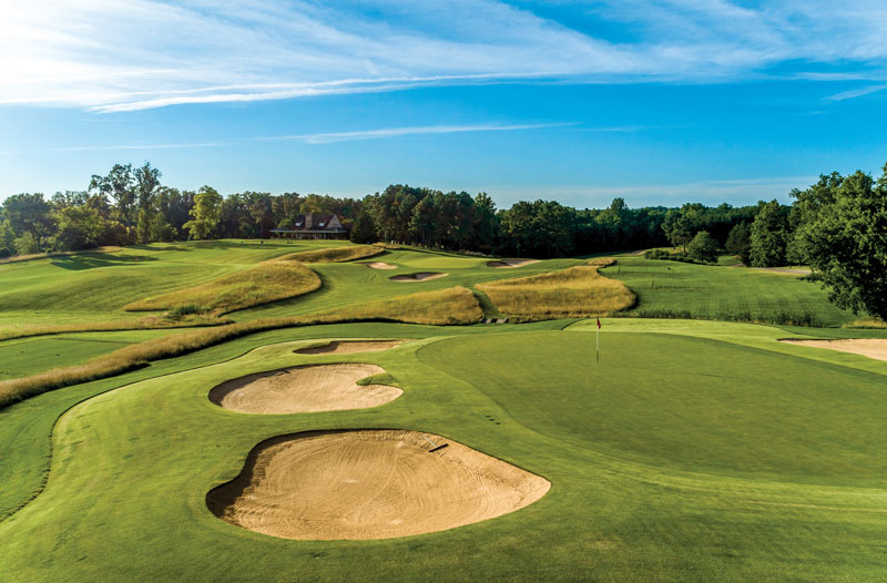
Drones can be used to capture scenic views, such as this shot of Kanawha Club in Manakin-Sabot, Va., or they can reveal far more when outfitted with sophisticated equipment such as infrared, radiometric or multispectral sensors. Photo courtesy of David Hunsucker and The Drone Co.-RVA
In part I of this series, What the Tech? Drones and aerial imaging, we introduced the idea of using unmanned aerial vehicles (UAVs), also known as drones, for golf course maintenance. We discussed general differences among types of aircraft, sensors, and the imagery they produce. Collectively, those individual components — the aircraft, camera/sensor, software used to control the flight or process images — are called an unmanned aerial system (UAS). Here, in part II, we will take a closer look at specific examples of UAS products and services currently available to golf course superintendents.
Focus your drone investment
As we saw in part I, whether we’re talking about flying a drone, capturing data with onboard cameras/sensors, or creating images and maps for further use, superintendents have the option of performing these actions in-house or contracting them out. When to choose hands-on vs. hands-off is the first consideration required when making UAS purchasing decisions.
As a part of that consideration, it’s helpful to simplify UAS technology into two basic categories: image acquisition and image processing. Image acquisition is all about flying and everything that happens up in the air. It involves the drone, the camera (or specialized sensor) and any apps used to plan or control the flight. Image processing is what takes place after the drone lands — turning the images and information acquired during the flight into the desired finished product. Processing usually involves some additional software. Talking about UAS technology in these terms is particularly useful when it comes to deciding exactly where to invest money and time.
What will you do with the finished product?
The other key consideration is to remember why you’re flying in the first place. How do you plan to use the images and information collected? There are plenty of reasons for wanting to use a drone on your course, and there’s no need to limit your ambition. But when it comes to making purchasing decisions, it’s important to not lose sight of the primary motivation for pursuing this technology in the first place.
There is no one-size-fits-all drone, as different objectives ultimately will align with different sensors, software and even the drones themselves. The more you can remain focused on what you’re trying to accomplish, the better suited you will be to purchase what you need and get the best return on your investment.
Typically, I encounter three general reasons golf courses become interested in using drones.
The first objective is simply to showcase the course. This involves the pretty pictures or stunning videos to be used for websites, social media or other marketing/promotional purposes. These days, a high-quality digital camera (RGB camera) comes standard on most UAVs, so there is little need to purchase much more than the drone itself for this purpose. If this is your primary motivation, focusing on the features of a drone’s built-in camera will give you the most bang for your buck. Although this is an area where contracting a professional photographer certainly has merit, with the entry-level cost for UAVs continuing to shrink, purchasing a UAV may allow you to address this objective and also go on to use the drone for additional, maintenance-related purposes.
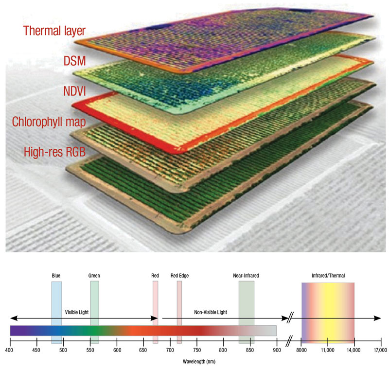
Figure 1. The Altum sensor from MicaSense captures traditional digital photos along with multispectral and thermal images during a single flight. Images courtesy of MicaSense
The second reason, which is definitely maintenance-related, is monitoring plant health. This is essentially using a drone to scout the course, and it can take place on several levels. It can work with the equipment already mentioned — a simple drone with a built-in RGB camera can provide benefits through its unique, overhead vantage point. However, where UAVs truly take monitoring plant health to the next level is when they are outfitted with a specialized sensor. Mainly we’re talking about a multispectral or infrared sensor. The images generated by these sensors can illuminate areas of stress in ways that are not naturally visible to the human eye or an RGB camera. For anyone seriously interested in monitoring plant health, looking into specialized sensors (or companies that use them) is certainly worth the time.
The third reason commonly cited for purchasing a drone is mapping. This isn’t as much about the condition of plants growing on the ground as it is the ground itself — the overall lay of the land. Through photogrammetry (discussed in part I) and a drone’s built-in camera, precise maps can be produced and analyzed, aiding in all types of physical measurements and calculations for distance, area and even volume. Because this application is extremely data-driven, concentrating on software used for image processing should be the focal point for purchasing decisions.
Obviously, these categories are neither exhaustive nor mutually exclusive, but they are largely representative of current superintendent interests. With these considerations in mind, we will highlight a few examples of UAS technology.
Drone image acquisition
Airframes and camera
The largest player in the UAV game is DJI, and at the time of writing this article, DJI’s lowest-priced model, the Ryze Tello (with 5-megapixel camera, 720p video and 13-minute flight time), lists for $99. From there, prices rise with increasing camera quality and in-flight features. Its Mavic- and Phantom-series drones range from $399 to $1,599, with cameras in the 12- to 48-megapixel range and flight times of approximately 30 minutes. Additional selling points for the more expensive models include obstacle avoidance and the gimbal — the part of a drone that actually holds and rotates the camera during flight.
Other UAV manufacturers include Parrot, Yuneec, Walkera and Hubsan, just to name a few. You can find lists of the top drones for less than $100, containing even more makes and models. With some of these models, you may see reduced flight times, lower camera resolution, and less emphasis on gimbal stabilization and obstacle avoidance. The take-home message here is, if you’re curious about what aerial images of your course would look like, UAV entry costs continue to become more accessible. For new drone users just learning to fly, an inexpensive model makes it much easier to stomach any particularly hard (or unintentional) landings that may occur.
Specialized sensors
What does a problem look like before it’s a problem? That is the essence of why infrared and multispectral sensors are so intriguing and appealing. Their cost and the fact that they have traditionally required a more expensive airframe tend to make them somewhat less accessible.
When it comes to infrared sensors (thermal cameras), FLIR is a recognized authority, not just for the products it sells, but as its thermal components are used by other manufacturers — DJI and MicaSense. A key to evaluating infrared sensors is whether they are radiometric, which basically boils down to how precisely temperature is being measured throughout the image. Radiometric sensors record a temperature for each pixel, while non-radiometric sensors do not, instead capturing relative differences in temperature within the overall image. Not surprisingly, while the FLIR Vue Pro (non-radiometric) begins at just over $2,100, its radiometric counterpart, the FLIR Vue Pro-R, starts at a little over $3,100.
Editor’s note: Find all past installments of “What the Tech?” and other insights on using technology in golf course management — from autonomous mowers to smartphone apps — at GCMOnline.com/Tech.
When it comes to multispectral sensors, companies such as Parrot, Sentera, Slant Range and MicaSense have products with potential application for turfgrass management. With these sensors, it’s not always an apples-to-apples comparison. Different manufacturers focus on different wavelengths (and combinations) of reflectance, but current prices range anywhere from ~$2,000 to $10,000. Despite the sizable price tag, multispectral sensors continue to evolve, as with models like MicaSense’s Altum, which combines multispectral, thermal and traditional RGB camera into a single device (Figure 1, above).
Drone image processing
All right, it’s time to put the cards on the table — the real power in UAS technology isn’t in the imagery, it’s in the information behind it. Drone images can be so visually striking that they dominate our attention, when, in reality, a UAV in flight is performing a host of measurements (telemetry data), to orient its position and ultimately infuse its images with numbers describing real space and distance, which are the building blocks of mapping. If you are seriously interested in mapping, other specialized sensors such as real-time kinematic (RTK) or lidar sensors can elevate precision to even greater levels. No matter what type of sensor is being used to provide telemetry data, the bottom line is, special software is needed to truly unlock all this information.
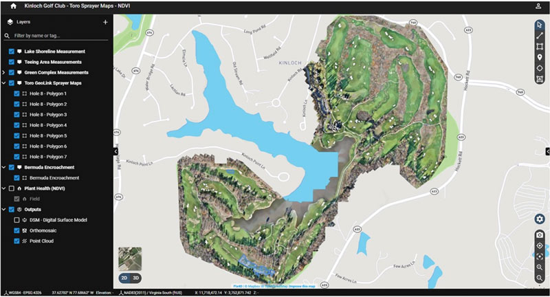
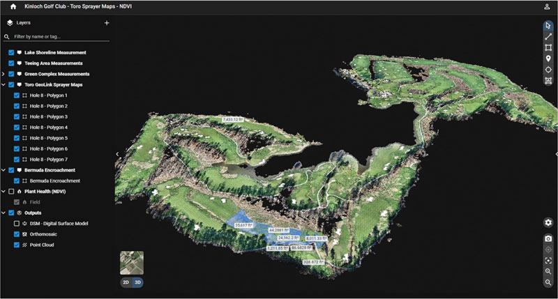
Figure 2. Pix4D software was used to create and analyze a two-dimensional (top) and three-dimensional (bottom) orthomosaic. Images courtesy of David Hunsucker and The Drone Co.-RVA
If you really want to be hands-on with the image-processing aspect of UAS technology, look into purchasing a program such as Pix4D Mapper, ESRI ArcGIS or Agisoft Metashape. These are powerful tools that give you full control when creating and analyzing orthomosaic maps (Figure 2, above). As with most quality software, these products come with a price tag and a learning curve. However, free trials are available.
For those who still want to fly the drone but do not want to process the images, companies such as DroneDeploy may offer a compromise. Among other services, DroneDeploy allows users to upload images, and then it performs the necessary task of turning those images into an orthomosaic, returning the finished product along with a “toolbox” for analyzing the data it contains. Similarly, DroneDeploy also offers a free trial for some of its services. If you would prefer to turn over all aspects of both flying and processing, companies such as The Drone Co.-RVA travel throughout the country visiting courses and conducting flights with their drones, and then subsequently process images and data for their customers (Figure 3, below). Beyond that, the next step would be hiring a company like GreenSight Agronomics, which (remotely) handles both image acquisition and image processing, using a drone housed at your course but piloted autonomously from its control center.
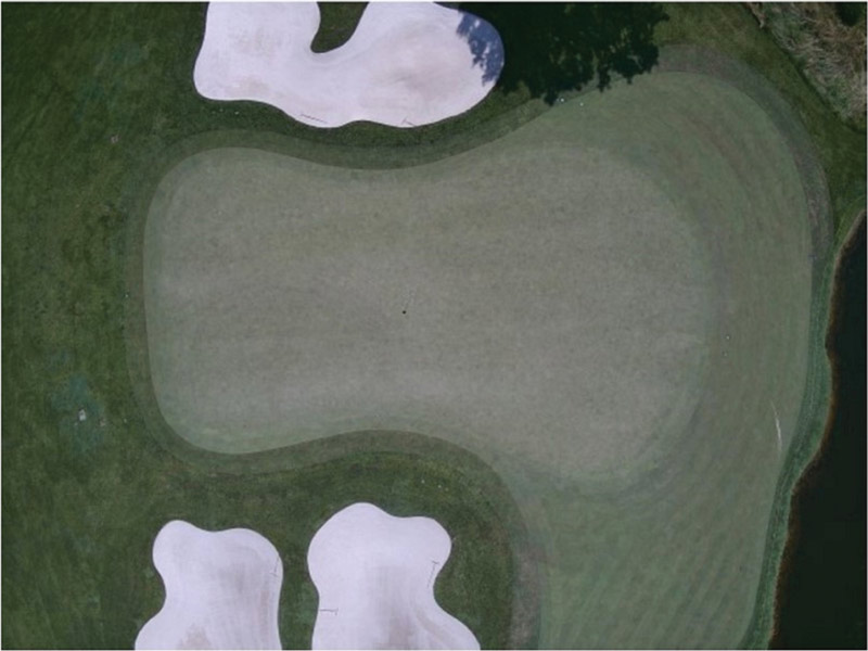
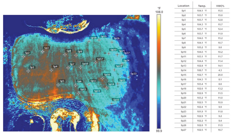
Figure 3. Aerial images of a putting green, comparing an RGB image (top) with a thermal image (bottom) that includes temperature data and volumetric water content (VWC) measurements for specific locations. Images courtesy of David Hunsucker and The Drone Co.-RVA
Conclusion
Regardless of whether any of this has changed your mind about UAS technology, we hope it has communicated that there’s more to it than just flying a drone. Saying that using UAS technology is all about flying a drone would be akin to saying that proper greens maintenance is all about mowing. The most visible part of the process is by no means the only part, and it’s only through appreciating and understanding those behind-the-scenes aspects — which contribute significantly to the overall operation — that you tap into the full potential of what success can look like.
Daniel O’Brien is a former program technician, Doug Karcher is a turfgrass soil specialist and professor, and Mike Richardson is a professor in the Department of Horticulture at the University of Arkansas in Fayetteville, Ark.